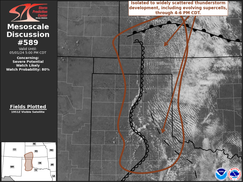
NWS Storm Prediction Center Norman OK
0257 PM CDT Wed May 01 2024
AREAS AFFECTED...parts of northwest Texas and the Texas Panhandle
into southwestern Kansas
CONCERNING...Severe potential...Watch likely
VALID 011957Z - 012200Z
PROBABILITY OF WATCH ISSUANCE...80 percent
SUMMARY...Isolated to widely scattered thunderstorm development
appears increasingly likely through 4-6 PM CDT, including the
evolution of supercells with potential to produce large hail in
excess of 2 inches in diameter, and a risk for TORNADOES.
DISCUSSION...Deepening convective development is evident
south-southeast through northeast of Amarillo, along a ....... more