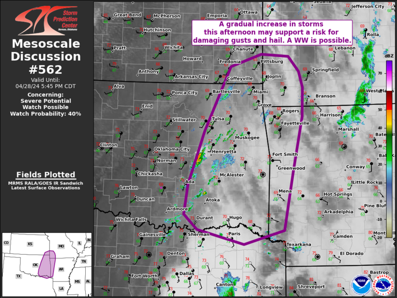
NWS Storm Prediction Center Norman OK
0338 PM CDT Sun Apr 28 2024
AREAS AFFECTED...portions of eastern OK...western Arkansas and into
far southeast KS and southwest MO.
CONCERNING...Severe potential...Watch possible
VALID 282038Z - 282245Z
PROBABILITY OF WATCH ISSUANCE...40 percent
SUMMARY...Weak showers may gradually deepen into clusters of strong
to severe storms late this afternoon. Uncertainty remains high as it
is unclear if the air mass can recover in the wake of earlier
storms. Trends will be monitored for a possible WW.
DISCUSSION...As of 2030 UTC, regional radar and satellite data
showed a few showers slowly deepening over ....... more