NWS Storm Prediction Center Norman OK
0926 PM CDT Fri May 03 2024
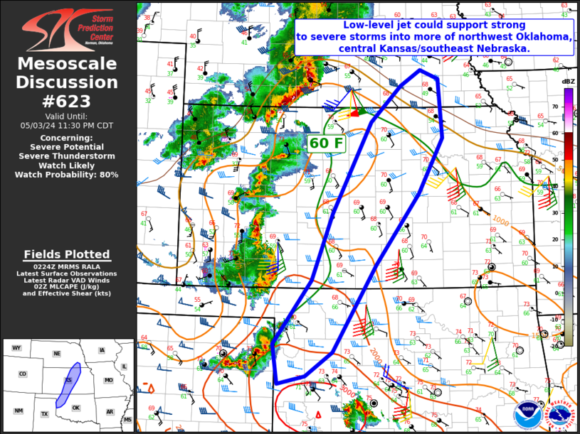
AREAS AFFECTED...Portions of northwest Oklahoma...central
Kansas...southeast Nebraska
CONCERNING...Severe potential...Severe Thunderstorm Watch likely
VALID 040226Z - 040430Z
PROBABILITY OF WATCH ISSUANCE...80 percent
SUMMARY...The environment should remain supportive of large hail and
SEVERE WIND GUSTS over the next few hours. A low-end tornado threat
will also exist, particularly for remaining discrete storms. A new
severe thunderstorm watch is likely.
DISCUSSION...Convection within the central/southern Plains continues
to move eastward this evening. Regional VAD ....... more