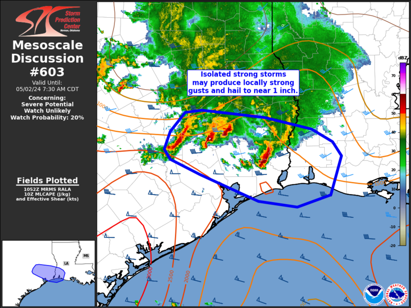
NWS Storm Prediction Center Norman OK
0554 AM CDT Thu May 02 2024
AREAS AFFECTED...southeast Texas into southwest Louisiana
CONCERNING...Severe potential...Watch unlikely
VALID 021054Z - 021230Z
PROBABILITY OF WATCH ISSUANCE...20 percent
SUMMARY...Strong thunderstorms may locally produce gusty winds or
hail to near 1 inch over the next couple of hours.
DISCUSSION...Isolated thunderstorms will continue shifting
east/southeast the next few hours. A 30-40 kt southerly low-level
jet and embedded, convectively induced MCV is likely aiding in
continued thunderstorm organization amid moderate instability
(MLCAPE 1500-2000 J/kg). Sporadic, ....... more