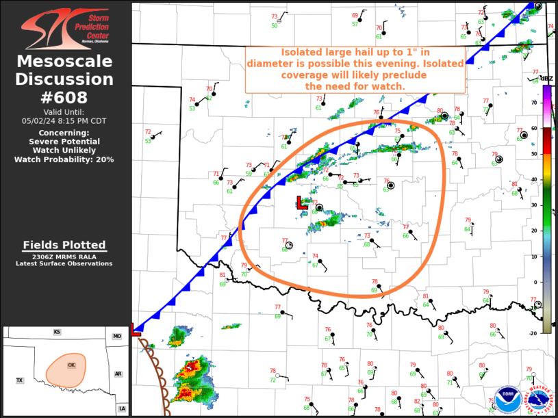
NWS Storm Prediction Center Norman OK
0608 PM CDT Thu May 02 2024
AREAS AFFECTED...Central/South-Central OK
CONCERNING...Severe potential...Watch unlikely
VALID 022308Z - 030115Z
PROBABILITY OF WATCH ISSUANCE...20 percent
SUMMARY...Isolated large hail up to 1" in diameter is possible
across portion of central and south-central Oklahoma this evening.
DISCUSSION...Recent radar and visible satellite imagery has shown
some modest increase in both thunderstorm coverage and intensity
over central OK during the past half hour or so, some of which
occurred along the cold front and some of which developed to the
southeast of a weak frontal ....... more