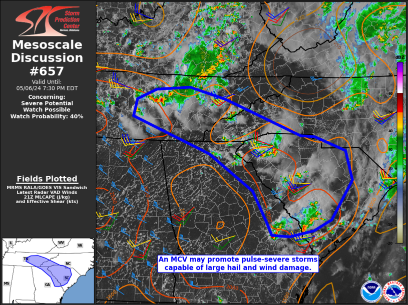
NWS Storm Prediction Center Norman OK
0453 PM CDT Mon May 06 2024
AREAS AFFECTED...Portions of South Carolina and Tennessee Valley
CONCERNING...Severe potential...Watch possible
VALID 062153Z - 062330Z
PROBABILITY OF WATCH ISSUANCE...40 percent
SUMMARY...Large hail and DAMAGING WINDS are possible with modestly
organized, pulse-severe storms in parts of the Tennessee Valley into
South Carolina. BRIEF TORNADOes are also possible for the next 1-2
hours in Middle/Eastern Tennessee with more discrete storms near the
MCV.
DISCUSSION...Large hail (with one 2 in. report) has occurred in
Middle Tennessee this afternoon. At least two TDS were ....... more
