NWS Storm Prediction Center Norman OK
0110 PM CDT Wed May 01 2024
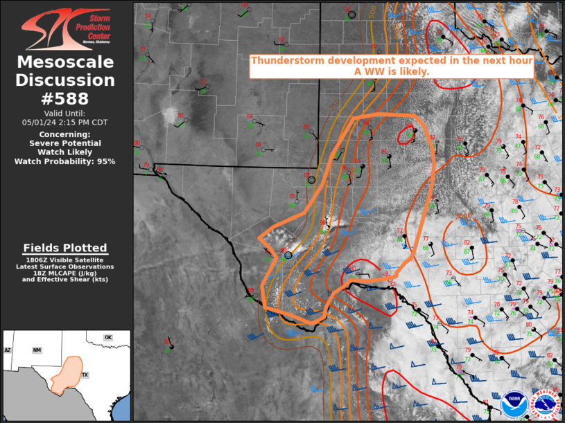
AREAS AFFECTED...West Texas
CONCERNING...Severe potential...Watch likely
VALID 011810Z - 011915Z
PROBABILITY OF WATCH ISSUANCE...95 percent
SUMMARY...Widely scattered to scattered thunderstorm development is
expected across portions of west Texas within the next hour. Large
hail exceeding 2 inches in diameter and wind gusts near 70 to 80 mph
are possible. A WW is likely in the next hour.
DISCUSSION...Visible satellite imagery shows increasing deepening
moist convection over the Davis Mountains and Stockton Plateau. A
dryline extends north to south on the western fringe ....... more