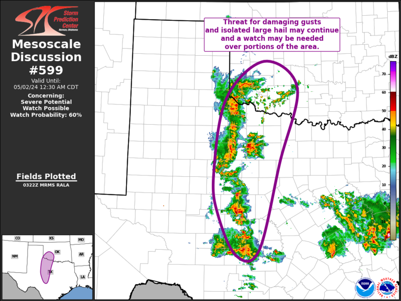
NWS Storm Prediction Center Norman OK
1024 PM CDT Wed May 01 2024
AREAS AFFECTED...Northwest and Southwest TX into Southwest OK
CONCERNING...Severe potential...Watch possible
VALID 020324Z - 020530Z
PROBABILITY OF WATCH ISSUANCE...60 percent
SUMMARY...Threat for damaging gust and isolated large hail may
continue eastward from southwest Oklahoma through northwest Texas
and into southwest Texas.
DISCUSSION...Regional radar imagery depicts a loosely organized,
eastward-progressing convective cluster moving into far southwest OK
and northwest TX, with its eastward propagation supported by outflow
from earlier storms over the southwest TX ....... more