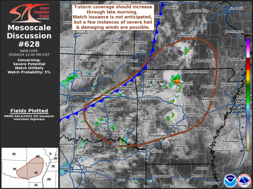
NWS Storm Prediction Center Norman OK
1236 PM CDT Sat May 04 2024
AREAS AFFECTED...West to southwest Texas
CONCERNING...Severe potential...Watch likely
VALID 041736Z - 042000Z
PROBABILITY OF WATCH ISSUANCE...80 percent
SUMMARY...Thunderstorm development along a southward-surging cold
front is likely within the next 1-2 hours with additional convection
expected later this afternoon across southwest TX. Given a favorable
environment for organized severe convection, one or more watches
will likely be needed in the coming hours.
DISCUSSION...Transient convection, along with a more robust cell
near Snyder, TX, is noted along and just ....... more