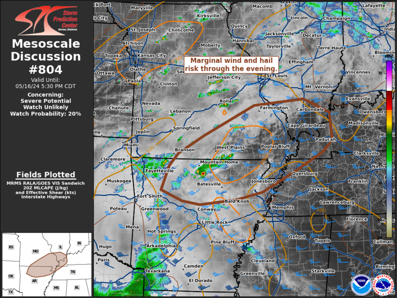
NWS Storm Prediction Center Norman OK
0325 PM CDT Thu May 16 2024
AREAS AFFECTED...northern Arkansas...south eastern
Missouri...southern Illinois...far western Kentucky
CONCERNING...Severe potential...Watch unlikely
VALID 162025Z - 162230Z
PROBABILITY OF WATCH ISSUANCE...20 percent
SUMMARY...Marginal wind and hail risk through the evening.
DISCUSSION...Thunderstorm activity is expected to increase in
coverage this afternoon and evening across portions of the Ozarks to
the middle Mississippi Valley. A few more organized clusters and a
supercell or two may be possible as forcing increases from a
mid-level speed max moves across this ....... more