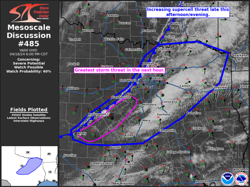
NWS Storm Prediction Center Norman OK
0402 PM CDT Thu Apr 18 2024
AREAS AFFECTED...central/north-central into northeast Texas
CONCERNING...Severe potential...Watch possible
VALID 182102Z - 182300Z
PROBABILITY OF WATCH ISSUANCE...40 percent
SUMMARY...The threat for isolated to widely scattered supercells
will increase late this afternoon into the early evening.
DISCUSSION...A very unstable airmass has developed across central
and northeast Texas with low to mid 70s dewpoints and temperatures
in the 80s. MLCAPE around 3000 J/kg and effective shear around 25 to
30 knots will support ORGANIZED STORMS including the potential ....... more