NWS Storm Prediction Center Norman OK
0309 PM CDT Fri May 03 2024
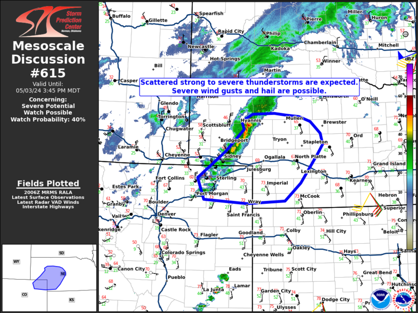
AREAS AFFECTED...Far northeastern Colorado and western Nebraska
CONCERNING...Severe potential...Watch possible
VALID 032009Z - 032145Z
PROBABILITY OF WATCH ISSUANCE...40 percent
SUMMARY...Scattered thunderstorms will continue to develop across
parts of western and northwestern Nebraska, and far northeastern
Colorado through this afternoon. SEVERE WIND GUSTS of 55 to 70 mph
and large hail near 1.25 to 1.75 inches will be possible.
DISCUSSION...Latest surface observations and visible satellite
imagery indicate a cold front advancing southward across the
panhandle of ....... more