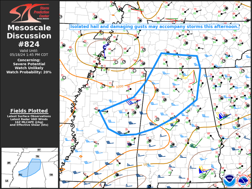
NWS Storm Prediction Center Norman OK
1144 AM CDT Sat May 18 2024
AREAS AFFECTED...Northeast MS into northern AL and southern middle
TN
CONCERNING...Severe potential...Watch unlikely
VALID 181644Z - 181845Z
PROBABILITY OF WATCH ISSUANCE...20 percent
SUMMARY...Isolated hail and DAMAGING GUSTS may accompany storms this
afternoon.
DISCUSSION...Convection associated with a compact midlevel low
(which is centered near the TN/AR/MS border) is gradually
intensifying late this morning from northeast MS into northern AL
and southern middle TN. Some continued increase in storm coverage
and intensity may continue into this afternoon, within a ....... more