NWS Storm Prediction Center Norman OK
0329 AM CDT Thu Apr 25 2024
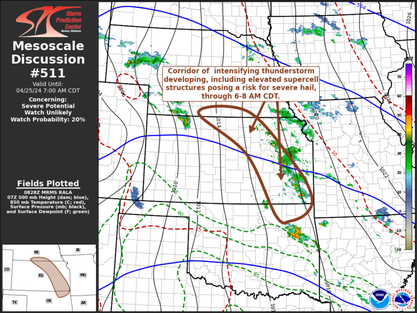
AREAS AFFECTED...parts of south central Nebraska through eastern
Kansas and adjacent northeastern Oklahoma
CONCERNING...Severe potential...Watch unlikely
VALID 250829Z - 251200Z
PROBABILITY OF WATCH ISSUANCE...20 percent
SUMMARY...Developing thunderstorm activity may occasionally
intensify with at least some increase in potential to produce severe
hail through 6-8 AM CDT. While it still appears unlikely that this
will require a severe weather watch, trends will be monitored for
this possibility.
DISCUSSION...Scattered thunderstorm development is well underway ....... more