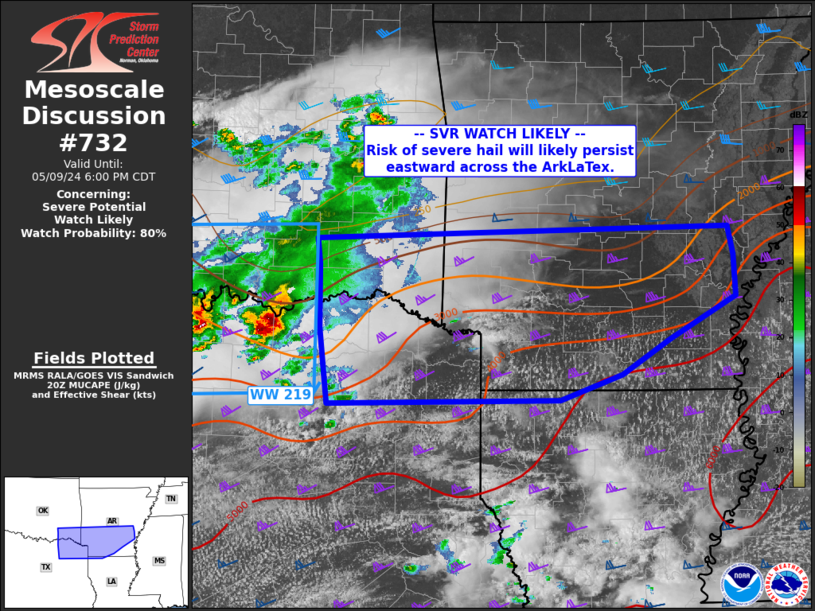
NWS Storm Prediction Center Norman OK
0326 PM CDT Thu May 09 2024
AREAS AFFECTED...From far northeast Texas across southern Arkansas
CONCERNING...Severe potential...Watch likely
VALID 092026Z - 092300Z
PROBABILITY OF WATCH ISSUANCE...80 percent
SUMMARY...Storms capable of large hail are expected to move east
across the ArkLaTex and into much of southern Arkansas through
evening.
DISCUSSION...Surface analysis shows an extensive stationary front
across northern TX and into southern AR and toward the MS/TN border.
South of this boundary, a very moist and unstable air mass exists
with MLCAPE exceeding 4000 J/kg. While low-level winds are ....... more
