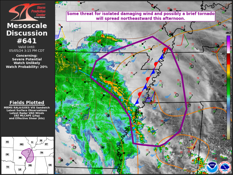
NWS Storm Prediction Center Norman OK
0116 PM CDT Sun May 05 2024
AREAS AFFECTED...Northeast AR...Southeast MO...Northwest
MS...Western TN
CONCERNING...Severe potential...Watch unlikely
VALID 051816Z - 052015Z
PROBABILITY OF WATCH ISSUANCE...20 percent
SUMMARY...Some threat for locally DAMAGING WINDS and a BRIEF TORNADO
will spread northeastward this afternoon.
DISCUSSION...A convectively enhanced shortwave trough is moving
northeastward across the ArkLaTex region this afternoon. A loosely
organized arc of convection is ongoing along the northeastern
periphery of the deeper cloud field associated with the shortwave,
from northeast AR ....... more