The Southern Indiana Weather Spotter's Reference
Serving the Tri-State with
LIVE
Radar & Weather Updates
Forecast:
FORECAST FOR THE EVANSVILLE, INDIANA AREA......
Retrieving Forecast Information
For the Region
Links:
Advanced Forecast
Amateur Radio
Amateur Satellites
Climatology
Current Conditions
Disaster Maps
Earthquake
Flood
Forums
Forecast
Home
Hurricanes
Jumpstart
Links
Models
NWS Offices
Radar
Satellite
Spotter Training
Storm Chase Live
Watches/Warnings
Winter
Local Forecast:
Indianapolis NWS
Louisville NWS
Paducah NWS
Nationwide
Current Visitors:
23
The Weather Channel Video
AccuWeather Video
|
|
Storm Prediction Center Severe Outlook
Day 1
Day 2
Day 3
Day 4-8
ArcGIS
SSEC
NWS GIS
Storm Prediction Center Severe Outlook (Indiana)
Experimental Graphical Hazardous Weather Outlook
Image Not Available
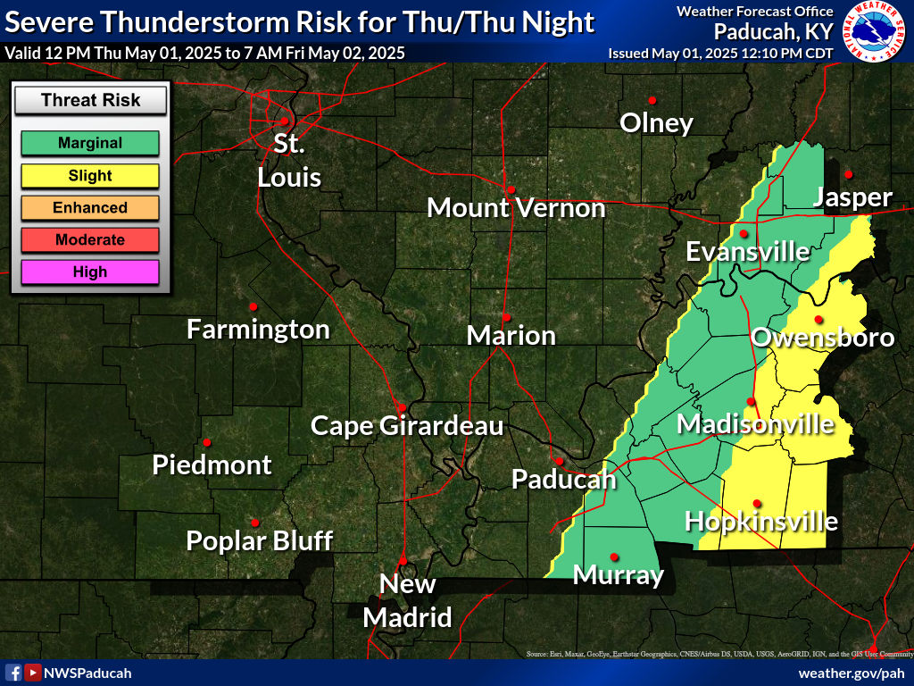
Paducah NWS
Image Not Available
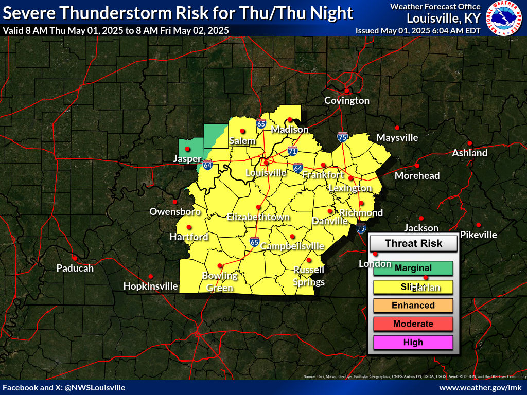
Louisville NWS
Image Not Available
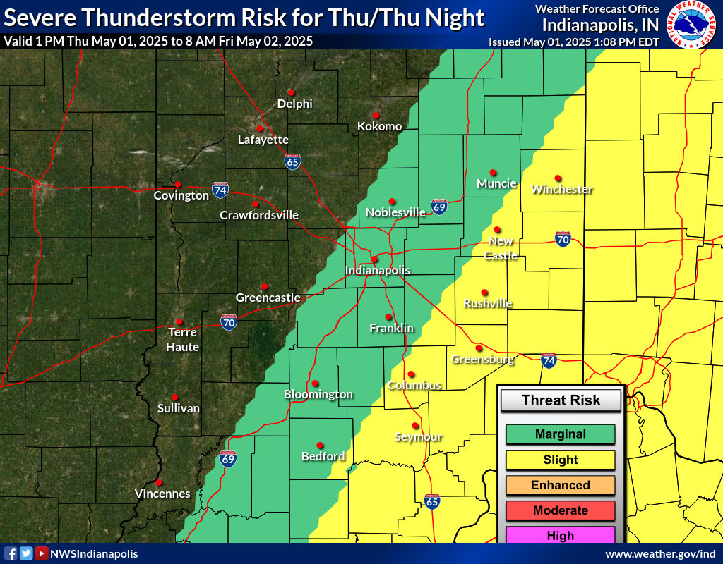
Indianapolis NWS
Weather Prediction Center Short Range Forecasts
Day 1
Day 2
Day 2.5
Weather Prediction Center Medium Range Forecasts
Day 3
Day 4
Day 5
Hazards Outlook
2.5 Day (WPC)
3-7 Day (WPC)
6-10 Day
8-14 Day (CPC)
Other Forecast Information
IDSS Point Forecasts
Weather Prediction Center
Fronts:
WPC 7-Day

 FORECAST FOR THE EVANSVILLE, INDIANA AREA......


 2.5 Day (WPC)